
est. 1988, Westerville, Ohio
|
est. 1988, Westerville, Ohio
|

Lots, sections, taxes
The interactive map below was created by the Franklin County auditor. For the clearest view click OK to the disclaimer and close the parcel data search box.
The auditor has also created a Levy Estimator tool, which not only estimates the impact of any upcoming and proposed levies but breaks down all current property tax into separate levies.
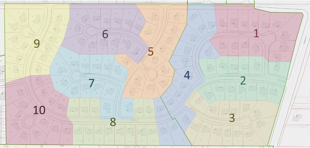
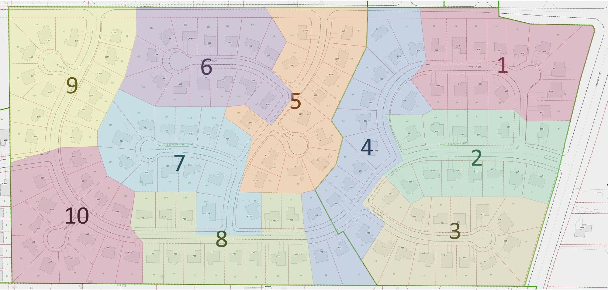
Here is a static map of the ten sections of the neighborhood, which have been used for electing trustees to the board. Click to expand in a new tab.
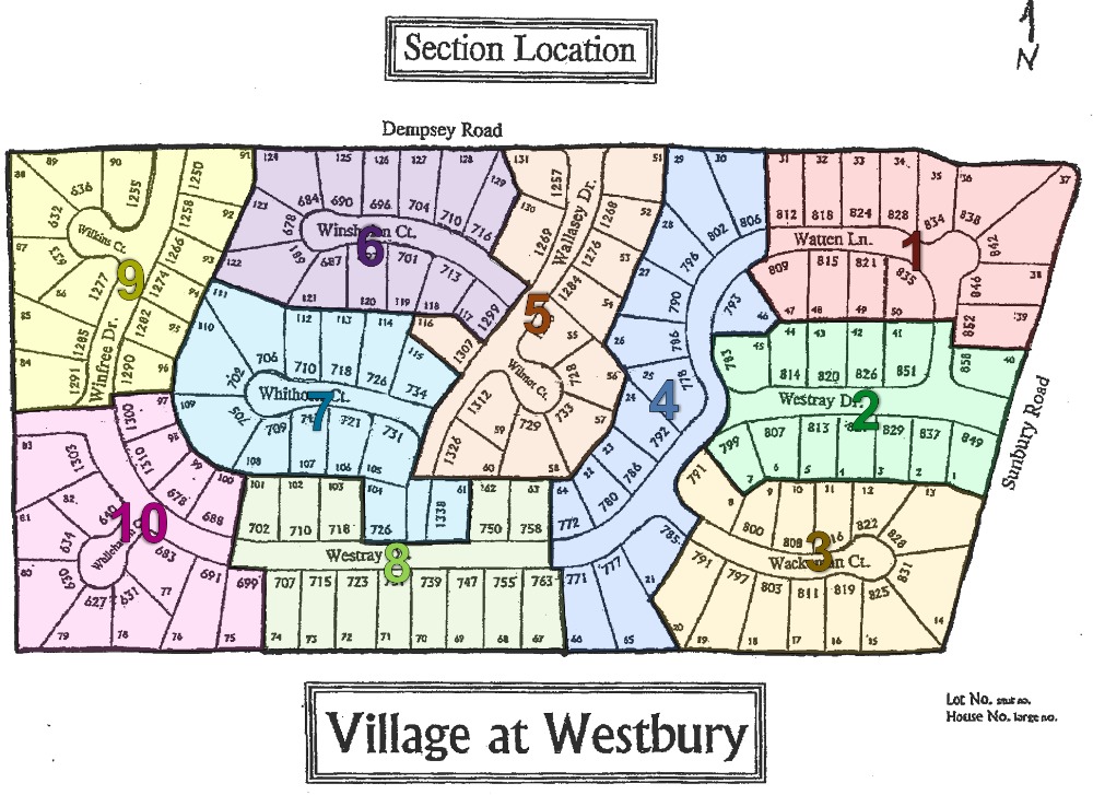
Here is a simpler version based on the original section drawing from the bylaws
The auditor has also created a Levy Estimator tool, which not only estimates the impact of any upcoming and proposed levies but breaks down all current property tax into separate levies.
Here is a static map of the ten sections of the neighborhood, which have been used for electing trustees to the board. Click to expand in a new tab.
Here is a simpler version based on the original section drawing from the bylaws

Pages
- Home
- Maps
- Find us here!
- Lots, sections, taxes
- Transport, healthcare, schools
- Plats
- Directories
- Board of directors
- Services & contractors
- Documents
- Governing documents
- Messages
- Announcements
- Lost & found
- Classified ads
- Garage sales
- Recipes
- FAQs
- Exemption requests
- Contact us
- Social media
- Nextdoor
- Coronavirus help
- Survey results
- Amendments
- Amendment information
- Amendment voting results